http://blog.skytruth.org/2010/05/gulf-oil-spill-radar-satellite-image.html
Saturday, May 8, 2010
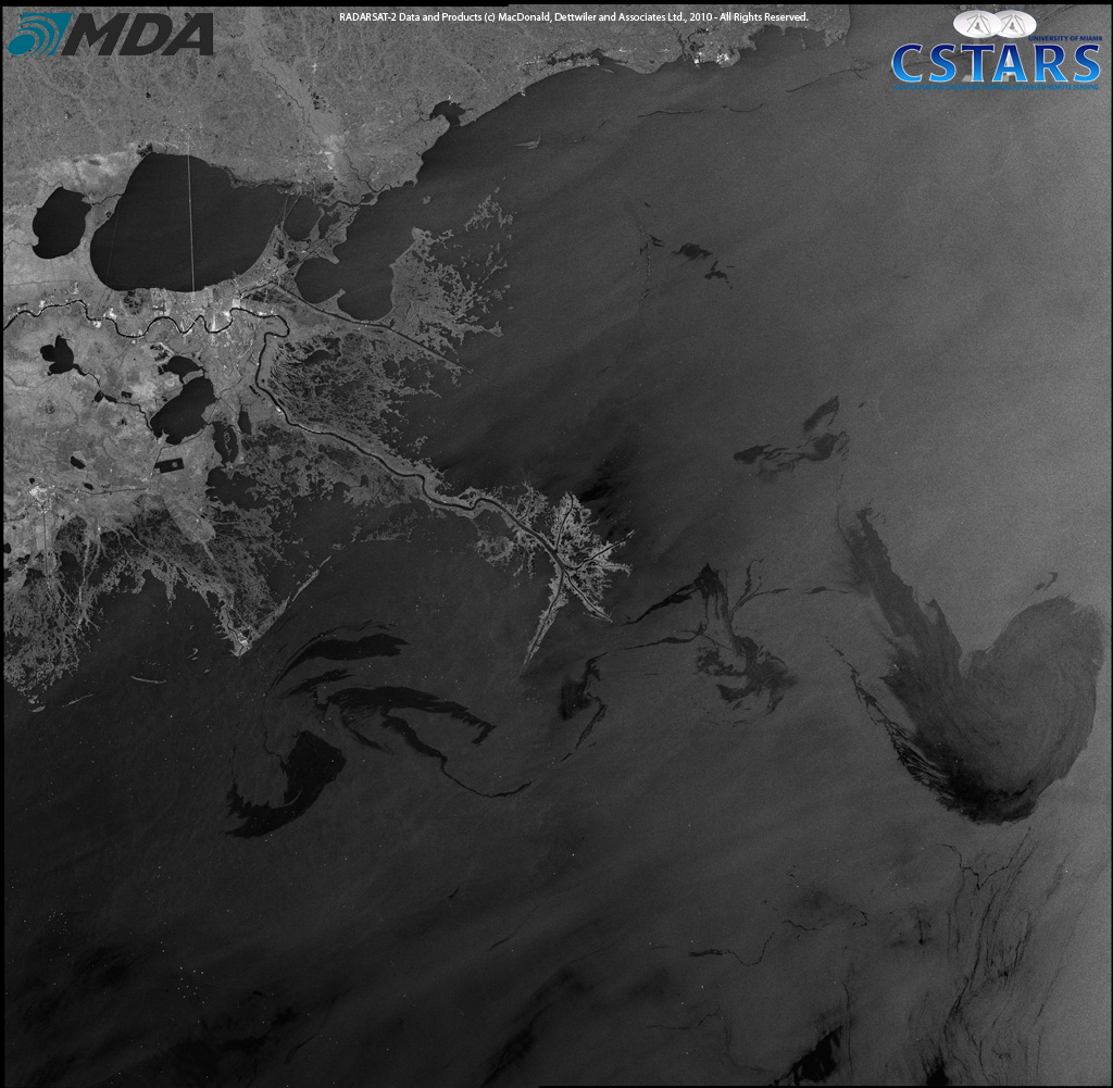 RADARSAT-2 image of the Gulf of Mexico, May, 8, 2010 – Source: CSTARS
We’ve added some analysis to help you armchair interpreters. Oil slicks look dark on radar images because the oil reduces the surface tension of the water, dampening (smoothing out) the small wavelets that normally roughen up the surface of the ocean. But any smooth water will look dark on radar, so not all dark patches are caused by oil:
 RADARSAT-2 image with SkyTruth analysis, May 8, 2010.
We estimate more than 18 million gallons of oil have spilled so far.
Now we can do a heads-up comparison of the RADARSAT-2 image with this MODIS/Terra image taken about four hours later. Still some clouds obscuring portions of the slick; observable slick and sheen spans about 4,100 square miles (10,624 km2). Fresh oil is apparent around the location of the leaking well; it seems to be carried to the southeast, then gets caught up in a counterclockwise gyre in the currents:
